OSIRISC – An observatory of coastal hazards in Brittany
UMR Geo-Ocean is involved in the ObServatoIre des RISques Côtiers (OSIRISC), which aims to develop an innovative interdisciplinary monitoring system to promote integrated and more effective coastal risk management by involving local inhabitants, socio-economic actors and local authorities on the Atlantic coast of Brittany.
OSIRISC is one of the five citizen observatories of natural hazards managed by the AGEO project (for the Atlantic GEOhazard Platform). All five observatories of the project are interested in rare phenomena with potentially significant impacts on urbanized coastal territories (marine submersion, coastal erosion, falling blocks, flooding, earthquake, etc.).
OSIRISC focuses on the observation of the vulnerability of coastal risks of erosion and submersion in Brittany
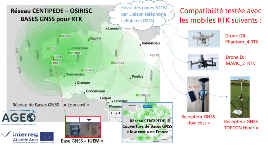
The GNSS backbone network for the coast of Western Brittany (figure opposite) is based on the CENTIPEDE project, which aims to create a network of open and available RTK bases for anyone in the coverage area (~50 km).


