Land-based monitoring
UMR Geo-Ocean contributes to the Permanent Accelerometric Network (RAP)
The Permanent Accelerometric Network RAP is a national network of instruments that record ground motion caused by earthquakes. It centralises the data and makes them available to all those involved in the analysis of the hazard and seismic risk. The RAP is a component of the RESIF, French seismological and geodesic network.
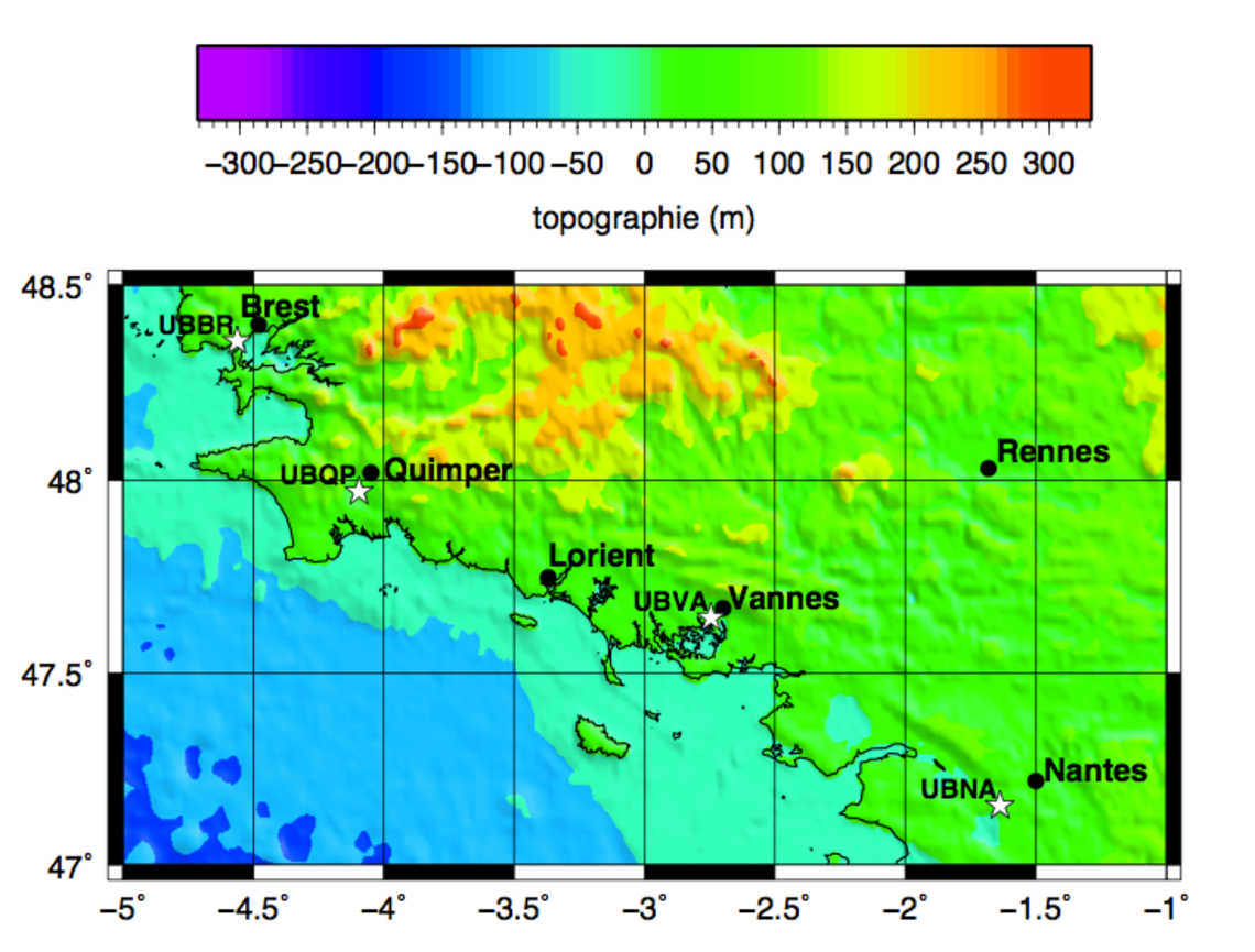
The RAP stations are grouped into regional networks managed by public bodies and institutions for seismological observation. UBO, via our UMR, is in charge of the RAP-UBO sub-network with the University of Brittany South and the University of Nantes, which includes 4 stations: UBBR, UBQP, UBVA and UBNA located on the figure opposite right
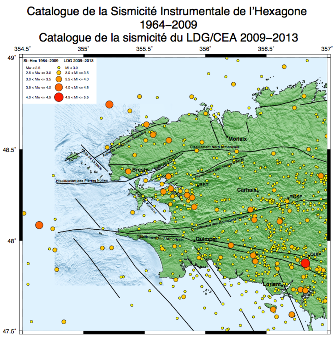
On the left, the map of the instrumental seismicity of Finistere made from the Si-Hex catalogue published by the French Seismological Central Office from 1964 to 2009 and from the LDG/CEA catalogue from 2009 to 2013.
It shows a low to moderate seismicity with magnitudes of 1 to 4.3 Mw. There are three RAP stations that have helped locate earthquakes. This does not allow to obtain a precise location of the earthquakes.
The topographical background of the map was based on topographical data from SHOM and IGN.


